Showing posts with label gps. Show all posts

Thursday, June 28, 2018

Alpen Tage 6 Obergurgl - Rotmoosjoch

Dotted lines: #notatrail

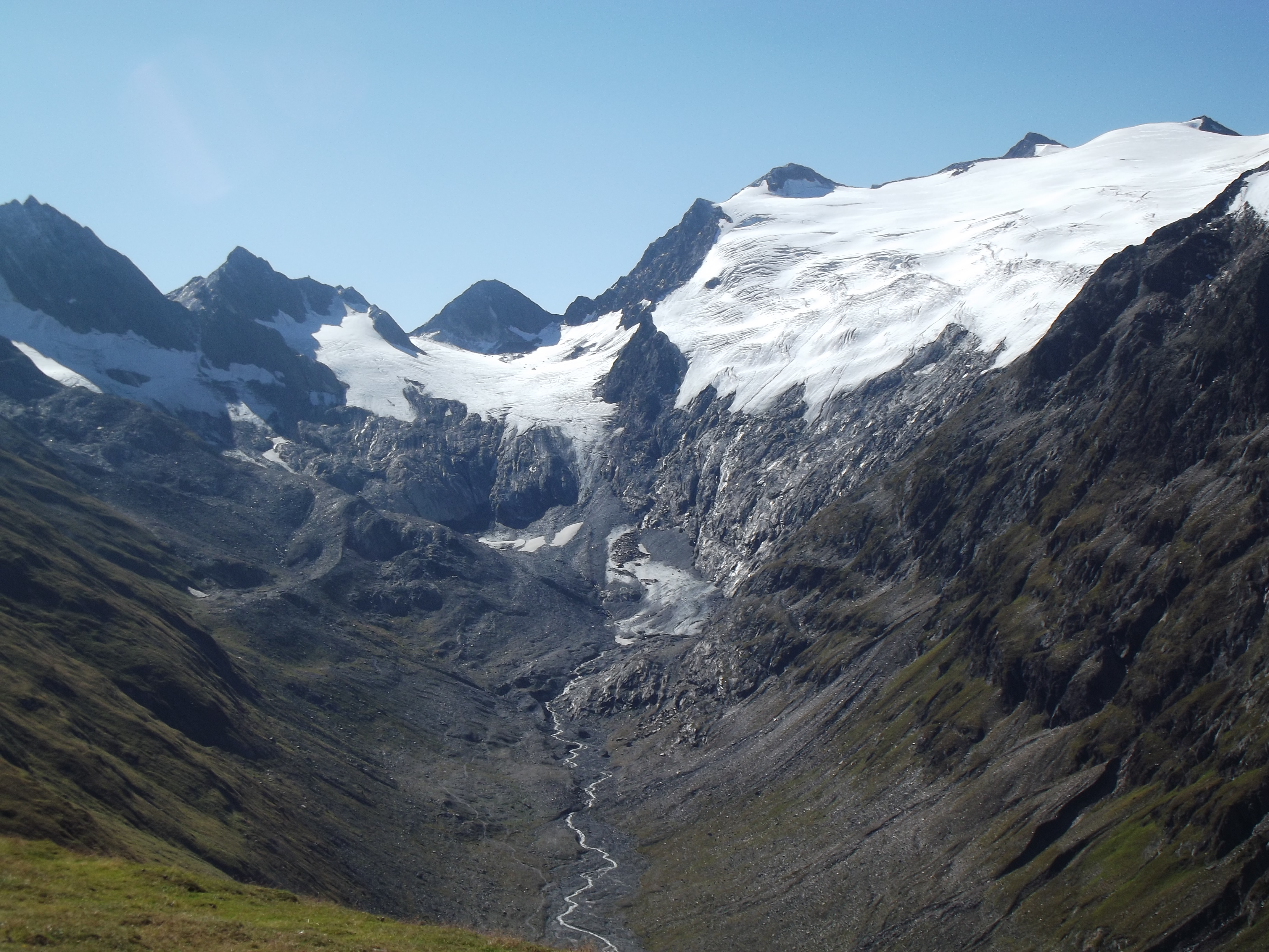
We went through Rotmoosferner  (Redmoss Glacier) in late June 2018 and found that climbing from the glacier to the ridge required snowshoes (slope > 70 degrees) due to deep unpacked snow. Visiting the Rotmoosferner trail is recommended to see the amazing rock debris left by the glacier melt. 

However, continuing the trail to cross over the mountain ridge to Rotmoosjoch (Redmoss Notch) should only be done with proper equipment and in July or August. The snow and rock slides are unstable and the ridge does not appear to have existing rock climbing attachments to clip into, unlike other ridge crossing trails in the Alps. We do not recommend attempting this crossing in June, or without proper equipment. 

Here is our GPS trace for this hike:

GPS trace recorded by MyTracks.

Here is a video of the hike which allows you to see the angle of assent/decent:


We followed a dotted trail which is shown on some maps to cross the ridge to get to the Zwickauer Hütte. Note: dotted trails are seasonal unmarked mountaineering trails which require rock climbing equipment.


The trail we followed was a dotted line trail, we found out later that means an unmarked seasonal mountaineering trail which requires rock climbing equipment.


Locals said it is recommended to try to cross there only in July or August, and only with a Bergfahrer (mountaineer) who can secure the attachments. 

It is an unmarked footpath (missing red/white markers on the ground). After the ground turns to snow and shifting rock, the path can be followed using GPS from the Ratmoosferner to the Ratmoosjoch. Once you get up to the ridge you will find the ridge does not appear to have existing rock climbing attachments to clip into at the GPS location of the joch (notch).

We climbed up until we could see the sun behind ridge through the fog. We could also see from Google Maps that we had reached the ridge. One of us went up to the rock face to look for attachments (blue dot in the image below). After what felt like 30 minutes of exploring the rock face, realized we would be unable to make the crossing, so we slid back down. 


At one point, we were able to see the sun was unblocked by further mountains.


GPS trace from Google Maps, show section from the Ratmoosferner (Redmoss Glacier) trail to the Ratmoosjoch (Redmoss Notch).


After we had slid down the glacier and we were in a stable location, I took a screenshot of where the GPS showed us. I forgot to snapshot it while we were on the incline, which showed we had made it across the Italian border, possibly due to GPS drift.

We spent a while at the ridge, the GPS trace shows lots of slipping (speeds of 5km/hour without changes in altitude.)


On a sunny day we would have been able to see the notch.


Wednesday, June 27, 2018

Alpen Tage 5 Huben - Langenfeld - Huben

This day we hiked to the next town and back as a day of rest. 

A day of rest, 9km walk from one village to another.

Tuesday, June 26, 2018

Saturday, June 23, 2018

Friday, June 22, 2018

Alpen Tage 2 Kemptner Hütte - Memminger Hütte

We hiked 29km from the Kemptner Hütte to the Memminger Hütte.


Overview of the hike:

GPS trace 

Video overview of the hike: 


Sleeping with ear plugs was magical. We had bread an muesli mit milch und milch cafe for breakfast. We got our things and went outside to fill the water bag and prep the bags for the day.

Well organized to maximize sleeping capacity.


We climbed out of the crater to a amazing view with shrubs. To the first crossing to another country into Austria by walking. We walked down, about halfway down passed a cafe which wasn't open yet (it was still only 8 am).
Morning view of hike out of the crater.


We saw the sign taking about the taxi from the town to Madau base of the mountain, we decided to take the walk to at least the Bach town, and re-evaluate there since it would be our longest day and didn't appear to be normal to walk it.

The hills and fields were beautiful, we got to town, changed from our boots to our shoes and called for info about the taxi. The dispatch said they didn't know when the taxi would be back. We went to the market to re-supply a bit, got meat and cheese and nectarines. We read the sign for the taxi and it said 60 euros for up to 4 people, we decided to keep going (we knew we could do the distance, and we are that cheap).

View of the village in the valley.


Leaving Bach towards Madau and found that the train was a pilgrimage trail with icons and benches along the way. We saw signs saying the village or the road would be closed that weekend. We were running really low on water for what we had left to do, with only 700ml of water left. Our trail led us on the west of the river, until we got to the turn in the road and saw that the GPS trace we were following wasn't a path, this was the first mishap of the Komoot app, we turned around and went back to where the village was supposed to be, and saw 1-2 signs for Gasthof, but no restaurants or markets on the road, and still no water.

We made some hiking staffs and started the gradual incline towards the mountains. We ate some  wurst and talked to a nice older couple who were also on their way to the Memmingen hütte. We found a horse/hiker watering trough with running water, as we had seen elsewhere in villages and filled our water pack. We got to the end of the road and saw the cable car for taking packs and supplies up to the house. We read the signs 16€ per pack, that you can call with the telephone up to the hütte, but we decided we had enough energy to just keep the bags since they weren't very heavy.

We are going up there!


We started the climb at around  3:30, expecting to be at the top way before 9pm (sunset) since we had only 2km left to do, but 1km vertical also. We met a group coming down who warned us that it would take a trip least 2 hours, we smiled. Probably they thought we were going for a day hike as well. Yes we know...

Every 100 meters in altitude on our GPS we paused and had cheese, fig, tomatoes or wurst in alternation. This system, and the cold water from the mountains spicket gave us energy and we made it to the top by 7pm!

We crossed a few waterfalls and ice flows. It was windy, we even put on our tuque and gloves. We got to see mountain goats in person and even saw them battle (or play) for king of the boulder.

Mountain goats


We finally arrived at 7pm just before the kitchen closing of 7h30, it took us way longer than expected to do that last 2km.

Hutte in the distance.


While waiting for dinner I started getting the chills and, and I did put on m my winter clothes, but still kept shivering. We sat with a mixed group of folks, one of them (I think the guide of the group) said Mathieu didn't speak German. The rest of  the table gave him an eye and said be careful, I had been speaking with them in German for over an hour before he arrived. He recovered by criticizing me of speaking hoch Deutsch. I shrugged. We ate most of our food to get energy and went out for a walk to enjoy the sunset and view the crystal mountain lake.

The view was breathtaking, and amazing!

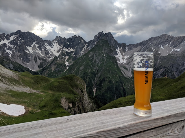
A wheat beer to enjoy the view.

Breathtaking view of the glassy lake at the top.


Again to bed early, tomorrow would be a short day only 14km, almost all downhill so we put in our earplugs and planned to wake up at 7:30... but of course at sunrise at 5.30am UP we were!

Thursday, June 21, 2018

Alpen Tage 1 Obersdorf - Kemptner Hütte

We hiked from Obsersdorf to the Kemptner Hütte.

GPS trace 

Video overview of the hike: 


We woke up early to get the 8am train. We walked by the trout to say goodbye, got coffee and our tickets.

The train platform listed two trains stopping at 8am, on the same platform. While we waited in the sun the train arrived. After waiting a few minutes we asked the conductor who was getting off his shift if that train went to Oberstdorf, he said yes, almost missing the train that was in our faces, in that zugteil, fortunately right on the platform where we had been waiting.


Inside the train car, the destination confirmed that it was going to Oberstdorf. Basically we found out it wasn't two trains that stopped, but instead one train with two engines, which would split mid way, the front engine continuing to au.. while the back engine to Oberstdorf!

We walked through the ski village of Oberstdorf, bought a pretzel bun tomato and cheese sandwich and then found the foot path that led up into the mountains.


We heard our first cacophony of cow bells in the hills.

Cow with bells that could be heard from several hundred meters.


After a little while, we stopped at a Gasthof for a beer and tea.

A beer in the valley.


We began to climb, saw our first rock slides, hid from sprinkles under a rain-forest style tree and had lunch. We saw a group retirees who passed us with their day-packs without realizing that we were there eating on a rock under a tree 1 meter away from them.

Climbing was slow going, getting used to the altitude, saw our first melting ice flows.

Finally around 7 pm we made it to the top of the mountains and we could see the Kemptner hut above us.

Kemptner Hütte above us.

We sat with two guys who told us that they were taking a taxi the next day, instead of the 29km we had planned. Dinner included svíčková and haluski, my favorite.

Walk after dinner.


We also got Glühwein and of course Witbier. We had schlafplatz near the door, with ear plugs slept the night through under heavy rain until it was time to wake up at sunrise 5:30.

Sunday, June 17, 2018

Hiking the E5

Next week we are going for a hike, a hike across the alps.


Tuesday, July 19, 2016

Hiking in Chiang Mai

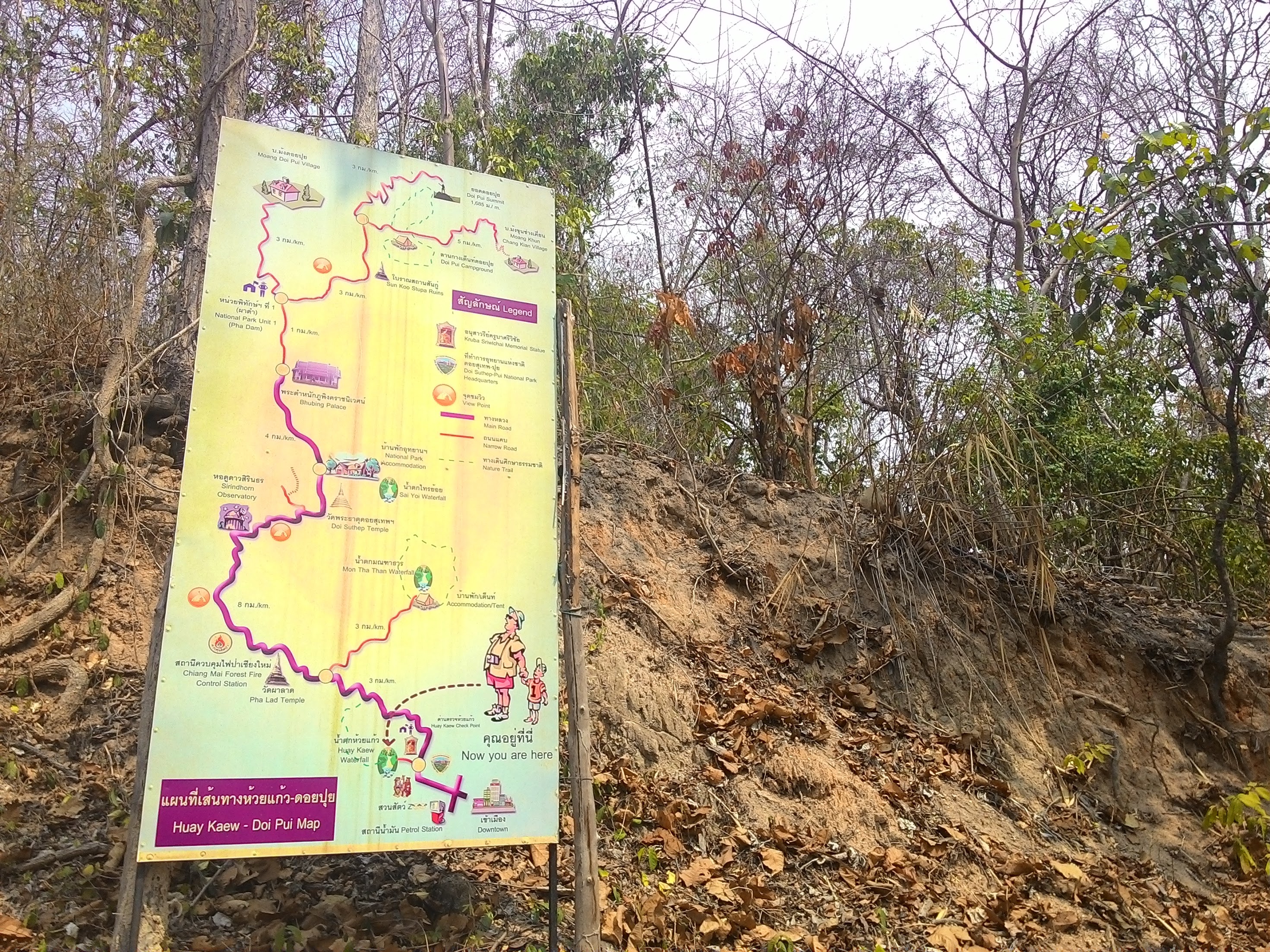
It turns out that there are plenty of trails around Chiang Mai which you can take to get to the summit of any mountain. The only challenge is finding them. We used GPS traces of other foreigners which we found after a fair bit of Googling.

One of our our recorded GPS trace

Elevation/Speed plot recoded by My Tracks
Trail info along the river.
The trails we found were mostly used by locals for pilgrimage to shrines, most mountains in that region have a shrine on top, so there is almost always a trail.

One of the trails was mostly a dried riverbed.
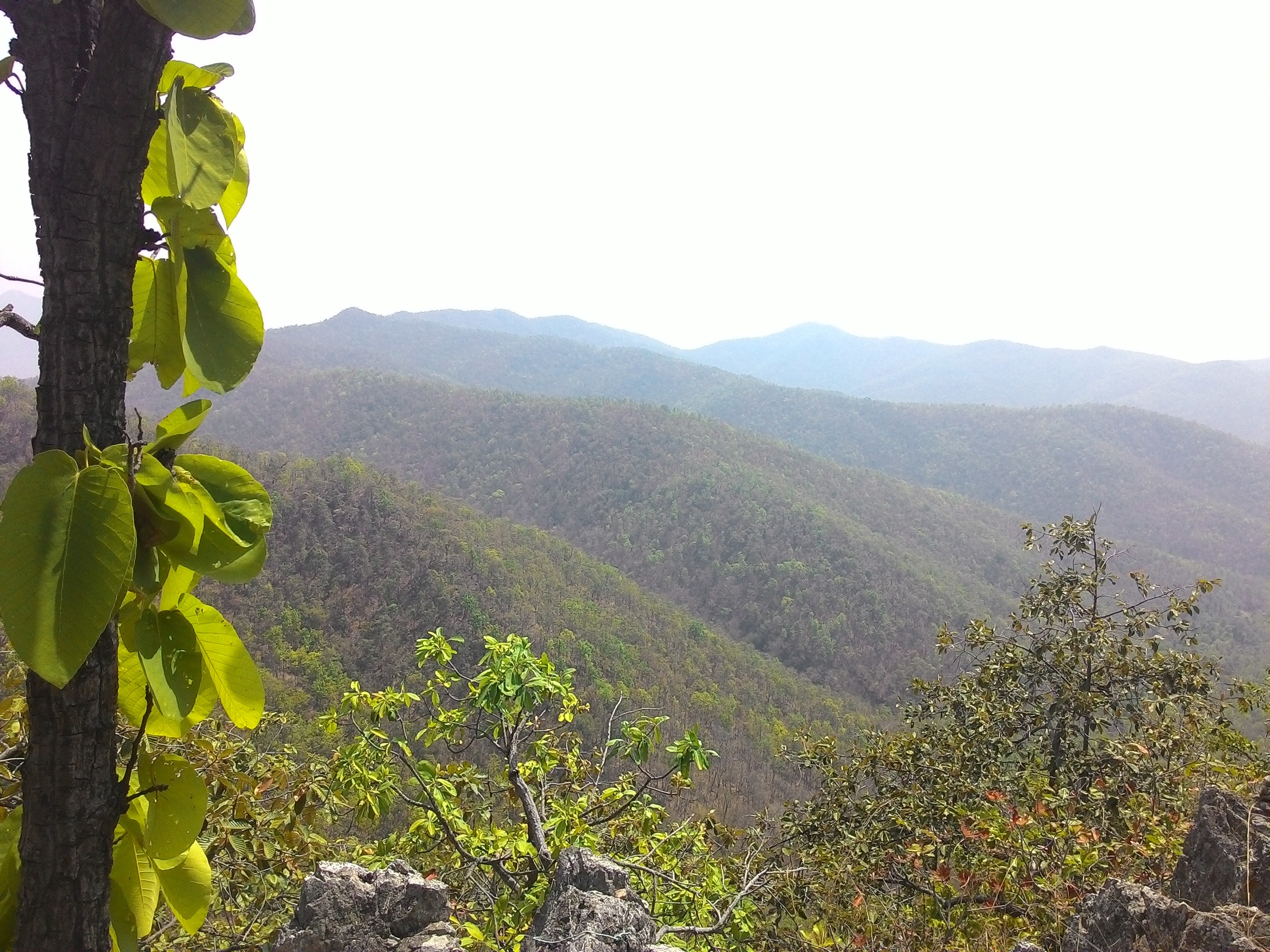
Hiking in March this year turned out to be a very hot endeavour. March is the dry season, and most of the mountains are control burned so that the land is black and the leaves shrivel and fall off. This makes very little cover from the sun.

The burning also makes the air have a high pollution index, and you can't see very far in the distance.

Monday, August 1, 2011

Le P'Tit Train du Nord Bike Trip


Day 1 - 109km @ 19.06km/h

Created by My Tracks on Android.

Total Distance: 109.23 km
Total Time: 9:53:21
Moving Time: 5:43:53
Average Speed: 11.05 km/h
Average Moving Speed: 19.06 km/h
Max Speed: 39.00 km/h
Min Elevation: 61 m
Max Elevation: 423 m (1388 ft)
Elevation Gain: 1825 m (5986 ft)
Max Grade: 24 %
Min Grade: -26 %
Recorded: Fri Jul 29 08:10:01 EDT 2011
Activity type: cycling


Day 2 - Part 1 : 62km @ 19.23km/h

Created by My Tracks on Android.

Total Distance: 61.74 km
Total Time: 5:08:52
Moving Time: 3:12:41
Average Speed: 11.99 km/h
Average Moving Speed: 19.23 km/h
Max Speed: 31.00 km/h
Min Elevation: 172 m
Max Elevation: 325 m
Elevation Gain: 788 m
Max Grade: 17 %
Min Grade: -18 %
Recorded: Sat Jul 30 07:36:59 EDT 2011


Day 2 - Part 2 : 27km @ 22.59km/hr

Created by My Tracks on Android.

Total Distance: 27.15 km
Total Time: 2:16:41
Moving Time: 1:12:07
Average Speed: 11.92 km/h
Average Moving Speed: 22.59 km/h
Max Speed: 35.00 km/h
Min Elevation: 177 m
Max Elevation: 300 m
Elevation Gain: 275 m
Max Grade: 10 %
Min Grade: -12 %
Recorded: Sat Jul 30 13:23:55 EDT 2011
Activity type: cycling

Sunday, July 3, 2011

Lake Champlain Bike Trip

A 7 day trip of about 620k (took a day off to visit family) ending with a free open air concert by Offenbach!


After 4 years and no week long bike trips, I finally took a vacation. I biked from Montreal down the Chambly canal to the Richelieu river and around Lake Champlain. The easiest and most beautiful section of the lake (Alburg Springs to Burlington 78k) was substituted by a hilly segment after visiting family (East Montpelier to Burlington 87k).

Lessons Learned
* Lakes are rivers which couldn't drain because they are surrounded by hills; roads surrounding lakes are NOT flat.
* Biking on a canal or a river is much, much flatter than biking around a lake.
* Biking around Lake Champlain Difficulty: medium to hard.
* Biking on a canal difficulty: easy.
* Recommendation for biking around Lake Champlain: have a support vehicle which drives around your camping gear, don't haul it up the mountains unless that's your goal (biking uphill with weight).

Bottom Line
* Before this trip I was heavily biased towards flat bike trips with minimal wind. Now I realize I actually like biking in hills, even up hills, because there's much less wind. However, my next fully loaded bike trip will be on the Erie canal :)

Total Feet Climbed: 20,108 ft !!!!
Max Grade Uphill: 29 % !!!
Min Elevation: -119 ft (in Montreal)
Max Elevation: 1088 ft (in Moretown VT)


The View was spectacular:


Total Flat Tires: none :)
Total Mechanical Problems: none :)

Total Distance: 620+ km
Total Time: 37:38:40 hours
Average Moving Speed: 15.52 km/h
Max Speed: 57.6 km/h (in Moretown VT when I climbed up into the Mountains on my 3rd day by mistake)

Recorded: Sat Jun 25 - Friday July 1 2011
Activity type: Cycling
GPS tracked by My Tracks on Android.


Maps used:


Montreal -> Saint Jean sur Richelieu (La Montérégie Pistes Cyclables 2011)
Saint Jean sur Richelieu -> Alburg Springs (Revivez l'aventure de Champlain à vélo)
East Montpelier -> Burlington (Google Maps)
Burlington -> Shelburne (Burlington Walk Bike Council bike map 3rd edition)
Shelburne VT -> Crown Point NY (Lake Champlain Bikeways Map New Edition)
Crown Point NY -> Ausable Chasm (Lake Champlain Region Mapguide of Essex County NY)
Ausable Chasm -> Saint Jean sur Richelieu (Revivez l'aventure de Champlain à vélo)

The Map I wanted to use:
Google biking directions cached on my Android...


The trip in pictures


Click on the picture to see a slide show of the pictures of the trip.


The trip in Elevation Statistics

Here are the track by track stats generated using My Tracks. It's an Open Source GPS tracking app for Android which gives you complete access to your stats and will generates Google maps and Google earth data for you... Hopefully the door to a future with readily accessible maps and directions for biking anywhere!

Montreal to Chambly: flat, mostly beautiful bike paths through the woods


Created by My Tracks on Android.
Total Distance: 41.92 km (26.0 mi)
Moving Time: 2:23:09
Average Moving Speed: 17.57 km/h (10.9 mi/h)
Max Speed: 33.35 km/h (20.7 mi/h)
Recorded: Sat Jun 25 12:13:48 EDT 2011


Montreal to Alburg Springs VT: flat, low traffic roads through fields and small villages from Saint Jean sur Richelieu to Alburg


Created by My Tracks on Android.
Total Distance: 96.21 km (59.8 mi)
Total Time: 7:52:20
Moving Time: 5:48:30
Average Moving Speed: 16.56 km/h (10.3 mi/h)
Max Speed: 32.85 km/h (20.4 mi/h)
Recorded: Sun Jun 26 09:48:38 EDT 2011


Montpelier to Moretown: good sized shoulder, low traffic, mostly paved except on Three Mile Bridge Road quite a few joggers and cyclists out training


In this section I got lost. Instead of turning right when I got to Middlesex, I turned left onto Route 100B (thinking it was Route 2). After a bit I realized the river was flowing the wrong way (the Winooski was flowing with me, the Mad River was flowing against me...) and that I had climbed up into the mountains. I opened the MyTracks app, and saw that the shape of my trajectory wasn't what I expected.

When I got to the intersection of 100B and 100 I had to decide, do I backtrack down where I came, or follow the sign that said "Stowe"... knowing full well that having the name of a popular ski resort town on the sign in the direction I was headed probably meant climbing...I decided to go "see what I could see" by climbing another mountain. It turned out I was right, the worst climbing was yet to come on Route 100 (the section of 20-24k in the graph below):)

Created by My Tracks on Android.
Total Distance: 27.01 km (16.8 mi)
Total Time: 1:55:59
Moving Time: 1:38:22
Average Moving Speed: 16.47 km/h (10.2 mi/h)
Max Speed: 47.70 km/h (29.6 mi/h)
Min Elevation: 117 m (383 ft)
Max Elevation: 323 m (1059 ft)
Elevation Gain: 432 m (1418 ft)
Max Grade: 6 %
Min Grade: -6 %
Recorded: Tue Jun 28 08:36:28 EDT 2011
Activity type: cycling


Moretown to Burlington: what goes up must come down...


When I figured I had reached the top I started a new track. Here we can see the profile of coming off the mountain, and then following Route 2 into Burlington. Just before Burlington there was a nasty hill (which my mom called "French Hill", I don't know what its actually called) where I could start to feel the wind coming off the lake, straight at me. It was a painful traffic filled ride into Burlington. The map which I got from Local Motion would have helped to avoid most of the traffic... I got to Burlington at around 3:00pm, went to Local Motion and headed south to get as far as I could that day.

Created by My Tracks on Android.
Total Distance: 53.97 km (33.5 mi)
Total Time: 4:28:18
Moving Time: 2:58:09
Average Moving Speed: 18.18 km/h (11.3 mi/h)
Max Speed: 57.60 km/h (35.8 mi/h)
Min Elevation: 5 m (18 ft)
Max Elevation: 332 m (1088 ft)
Elevation Gain: 459 m (1506 ft)
Max Grade: 4 %
Min Grade: -9 %
Recorded: Tue Jun 28 10:32:42 EDT 2011


Burlington to Charlotte: good sized shoulder lots of hills...


The hills around Burlington were particularly frustrating, amplified by my being tired due to my unexpected detour that morning into the hills of Central Vermont and a wind from the south at around 20k/hr effectively putting my speed at only 10k an hour :( You can easily see the profile of the hills here in this graph.


Created by My Tracks on Android.
Total Distance: 14.53 km (9.0 mi)
Total Time: 1:38:48
Moving Time: 1:22:47
Average Moving Speed: 10.53 km/h (6.5 mi/h)
Max Speed: 49.50 km/h (30.8 mi/h)
Min Elevation: 1 m (3 ft)
Max Elevation: 88 m (288 ft)
Elevation Gain: 268 m (880 ft)
Recorded: Tue Jun 28 15:12:42 EDT 2011


Charlotte to Button Bay: lots of hills...


Created by My Tracks on Android.
Total Distance: 29.79 km (18.5 mi)
Total Time: 2:37:11
Moving Time: 1:58:19
Average Moving Speed: 15.11 km/h (9.4 mi/h)
Max Speed: 44.10 km/h (27.4 mi/h)
Elevation Gain: 380 m (1247 ft)
Max Grade: 29 %
Min Grade: -9 %
Recorded: Wed Jun 29 06:19:06 EDT 2011


Button Bay to Port Henry: flat and beautiful scenery


The Bridge at Crown Point was taken down about a year and a half ago, and replaced with a Ferry. So I even got to go on a ferry ride :) As you can see from the graph below, there weren't a lot of painful hills. They just started on the climb into to Port Henry. Route 9 is about the only way to go north on the New York side, some sections of the pavement are actually full of waves, not due to being covered in flood water, but due to waves of trucks crossing over it. The nice lady at the welcome center in Crown Point suggested that I gun it when there was low visibility. The cars and trucks were very nice, there wasn't too much traffic so they moved to the other side of the road when passing me. Although it could have been a bad section to ride on I found it was fine, maybe just because I was happy to have the wind at my back (my average speed was back up to 15k/hr).


Created by My Tracks on Android.
Total Distance: 32.69 km (20.3 mi)
Total Time: 3:32:43
Moving Time: 2:10:28
Average Moving Speed: 15.03 km/h (9.3 mi/h)
Max Speed: 40.70 km/h (25.3 mi/h)
Recorded: Wed Jun 29 11:31:28 EDT 2011


Port Henry to Willisboro: Hills of hell part 1


In this stretch I was very very happy for my rear view mirror. The road was smooth and I could take the entire lane to go down the hills (I had some pretty steep decent and I didn't want to melt my brakes).

I also realized why my Lake Champlain Bikeways Map had the entire New York side north of Whitehall green: it's some sort of nature preserve. What this means is that the land is too mountainous for anyone to have built any sizable farms, so there were so few residents that it's basically a state park. That's also why when you drive through upstate New York on 87, all you see are mountains and no towns. The cutest town was Westport and about the only place to buy groceries was at the Deli just south of Willisboro. The lady at the Welcome Center in Crown Point recommended camping at Noblewood Park. It was a pretty simple park, and didn't open until July 1st... so I was 3 days early.

Created by My Tracks on Android.
Total Distance: 40.67 km (25.3 mi)
Total Time: 3:26:49
Moving Time: 2:33:56
Average Moving Speed: 15.85 km/h (9.9 mi/h)
Max Speed: 55.02 km/h (34.2 mi/h)
Min Elevation: -4 m (-12 ft)
Max Elevation: 159 m (522 ft)
Elevation Gain: 653 m (2143 ft)
Max Grade: 5 %
Min Grade: -13 %
Recorded: Wed Jun 29 15:34:39 EDT 2011
Activity type: cycling


Willisboro to Ausable Chasm: Hills of hell part 2


I did some leisurely hiking on Thursday Morning. I didn't have the strength to shift gears and still maintain momentum to accommodate for the roller coaster up hill shapes as can be seen in the graph below. The first bump is probably Rattlesnake mountain, the second and third bumps are on Highlands Road to Port Douglas. That road turned out to be the most beautiful part of my trip. It started off as a dirt road and became pavement after a little while. There were probably 2 cars the entire way, mostly just residents since the road basically lead from the middle of nowhere into the non-town of Port Douglas.

Created by My Tracks on Android.
Total Distance: 25.95 km (16.1 mi)
Total Time: 3:11:08
Moving Time: 2:00:07
Average Moving Speed: 12.96 km/h (8.1 mi/h)
Max Speed: 53.10 km/h (33.0 mi/h)
Min Elevation: -3 m (-10 ft)
Max Elevation: 183 m (600 ft)
Elevation Gain: 607 m (1992 ft)
Max Grade: 7 %
Min Grade: -13 %
Recorded: Thu Jun 30 09:10:06 EDT 2011


Ausable Chasm to Saint Jean sur Richelieu: one loooong afternoon ending with an Offenbach Concert in the park!!!


After eating lunch at the Ausable Chasm Cafe and using their Wifi the rest was downhill. I had no trouble getting to Platsburg. Relaxed for an hour or two on the beach, and then biked all the way to Saint Jean sur Richelieu. I didn't think I could make it but I managed to pull into town just as the last light was fading and all my fruit was gone. I parked by bike just infront of the entrance for the Ofenbach free open air concert, had 2 beers and 2 hotdogs to celebrate!


Created by My Tracks on Android.
Total Distance: 101.67 km (63.2 mi)
Total Time: 8:05:18
Moving Time: 7:35:34
Average Moving Speed: 13.39 km/h (8.3 mi/h)
Max Speed: 54.00 km/h (33.6 mi/h)
Min Elevation: 0 m (-1 ft)
Max Elevation: 85 m (279 ft)
Elevation Gain: 659 m (2162 ft)
Max Grade: 9 %
Min Grade: -8 %
Recorded: Thu Jun 30 13:30:36 EDT 2011

(For some reason my elevation stats are cut off, but suffice it to say, it was flat..)